OS Explorer Laminated / Kielder Water
Ordnance Survey Explorer maps use a smaller 1:25,000 scale to provide unrivalled levels of detail. Route planning is made easy with rights of way markers for footpaths, bridleways and byways, plus symbols for campsites, youth hostels and other services.
Full topographic mapping displays elevation contours at every 5m, or every 10 metres for upland areas, allowing pinpoint navigation. This makes Explorer maps ideal for activities like hillwalking, hiking, mountaineering, trail running and mountain biking.
The Active series of maps are also laminated, making them fully waterproof and tearproof for all-weather use. This means you don’t have to worry about your map disintegrating into a soggy mush when you’ve forgotten your map case again...
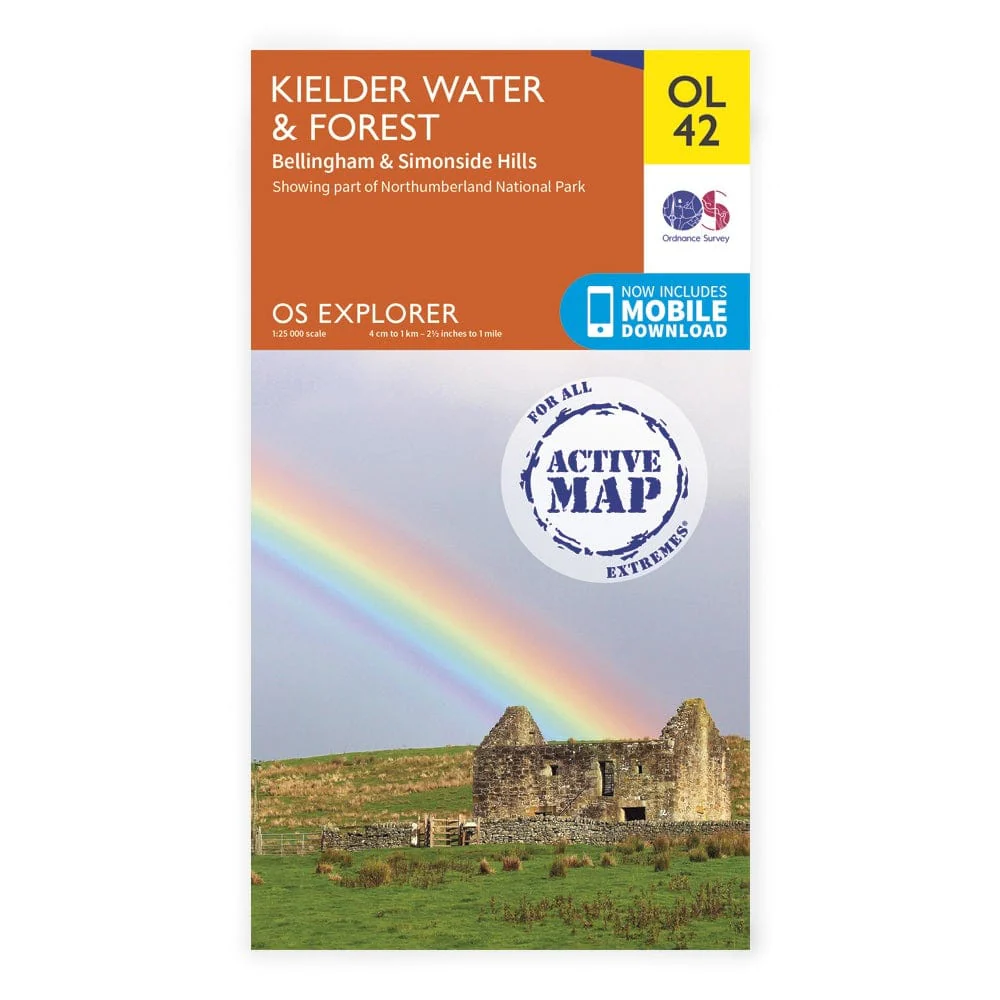
Explorer Active OL42 covers part of the Northumberland National Park, including the Pennine Way, E2, Kielder Water and the Simonside Hills.
Ordnance Survey Explorer maps use a smaller 1:25,000 scale to provide unrivalled levels of detail. Route planning is made easy with rights of way markers for footpaths, bridleways and byways, plus symbols for campsites, youth hostels and other services.
Full topographic mapping displays elevation contours at every 5m, or every 10 metres for upland areas, allowing pinpoint navigation. This makes Explorer maps ideal for activities like hillwalking, hiking, mountaineering, trail running and mountain biking.
The Active series of maps are also laminated, making them fully waterproof and tearproof for all-weather use. This means you don’t have to worry about your map disintegrating into a soggy mush when you’ve forgotten your map case again...
Explorer Active OL42 covers part of the Northumberland National Park, including the Pennine Way, E2, Kielder Water and the Simonside Hills.
Original: $23.22
-65%$23.22
$8.13Description
Ordnance Survey Explorer maps use a smaller 1:25,000 scale to provide unrivalled levels of detail. Route planning is made easy with rights of way markers for footpaths, bridleways and byways, plus symbols for campsites, youth hostels and other services.
Full topographic mapping displays elevation contours at every 5m, or every 10 metres for upland areas, allowing pinpoint navigation. This makes Explorer maps ideal for activities like hillwalking, hiking, mountaineering, trail running and mountain biking.
The Active series of maps are also laminated, making them fully waterproof and tearproof for all-weather use. This means you don’t have to worry about your map disintegrating into a soggy mush when you’ve forgotten your map case again...
Explorer Active OL42 covers part of the Northumberland National Park, including the Pennine Way, E2, Kielder Water and the Simonside Hills.